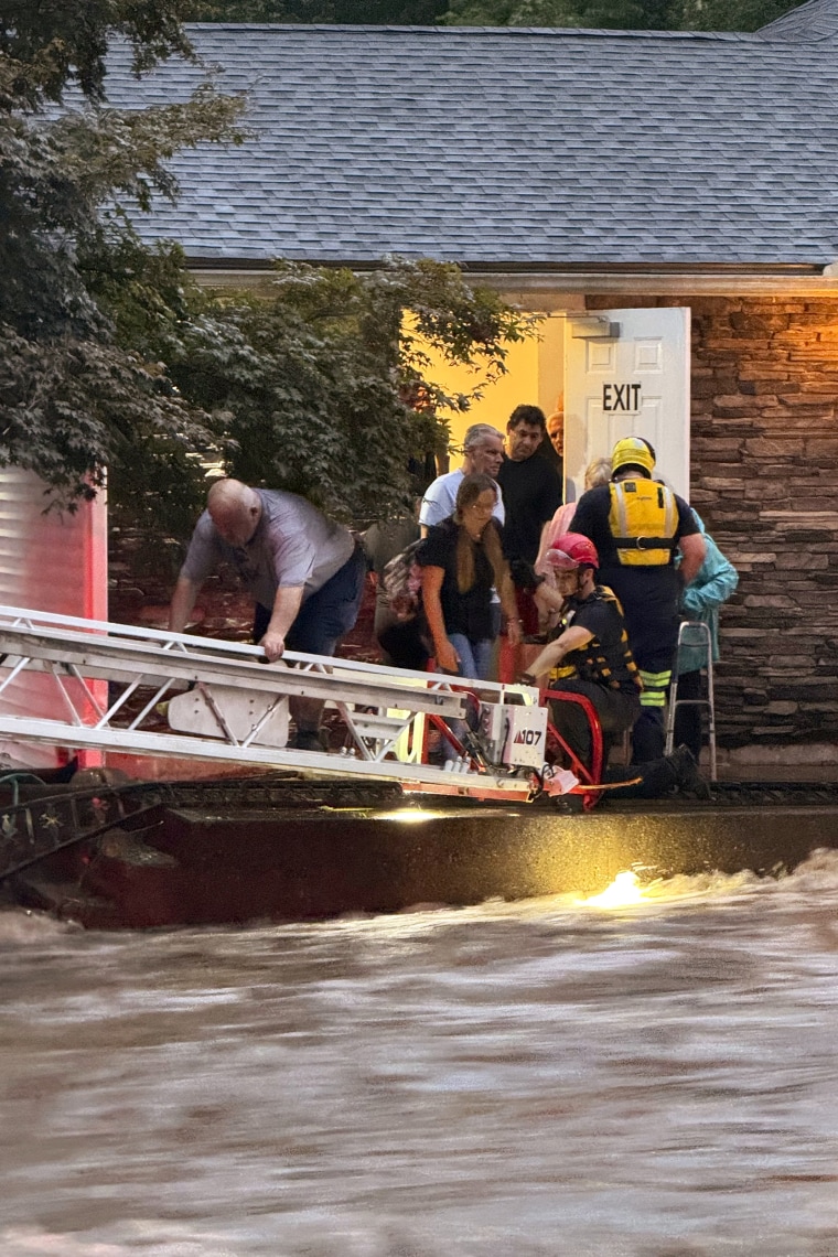
In two places on the same night, the storm that deluged the Northeast this weekend dumped rain at or near rates that should be expected only once in a thousand years.
The storm killed at least three people and caused widespread flooding. It dropped about 10 inches of rain over 12 hours on Sunday in parts of Connecticut including Oxford and Southbury. About 35 miles away, about 6.7 inches of rain fell in three hours on Sunday night in Stony Brook, New York. Both are measures that would have roughly a 0.1% chance of happening in a year, according to federal rainfall probability data.
“There were two areas that got sort of equally extreme rainfall, and they didn’t happen at the same time,” said Nick Bassill, director of the state weather risk communication center at the University at Albany in New York. “Any one of those would be noteworthy, and it’s interesting not only that we got two of them in the larger storm pattern, but that they were consecutive.”
It’s impossible to immediately determine the influence of climate change on a particular event, but scientists said the one-two punch of extreme rainfall fits the pattern in the Northeast, where more severe storms are growing increasingly likely.
“These thunderstorms now are packing more rainfall,” said Mark Wysocki, who recently retired as New York state’s climatologist.

For every degree of warming in Fahrenheit, the atmosphere can hold about 3% to 4% more moisture. In 2023, global temperatures were roughly 2.4 degrees F higher than they were in preindustrial times, meaning today’s storms can deliver a stronger punch.
Indeed, extreme precipitation events have increased significantly in the Northeast. The 2023 National Climate Assessment found that days with 3 inches of precipitation or more went up about 62% from 1958 to 2018. The number of days with at least 5 inches of precipitation more than doubled during that period.
Such storms are stressing infrastructure — roadways, stormwater systems and pipes — that was designed for a more moderate climate.
“We have to be more concerned about flash floods occurring and how we think in the future in design, in urban planning and so forth,” Wysocki said.
Some scientists also think that climate change is altering the behavior of the jet stream and making it more likely for areas of high and low pressure to stall, or become blocked. That could cause storm systems to linger longer over one region, delivering more moisture. But the research is preliminary and difficult for scientists to prove or disprove with confidence.
In the Northeast this weekend, a slow-moving front brought thunderstorms with intense localized rainfall, meaning some areas took exceptionally hard hits and some areas were relatively spared.
Mona Hemmati, a postdoctoral research scientist at Columbia University in New York City, said that’s a relatively unusual setup for extreme rainfall.
“This usually happens with hurricanes or the remnants of hurricanes,” she said. “This was not associated with hurricanes.”
The storm has highlighted well-known infrastructure deficiencies in the face of increasingly extreme conditions. As a whole, cities and towns in the Northeast aren’t designed for such intense rainfall.
Bassill said New York City’s sewer pipes are designed to handle about 1.75 inches of rainfall per hour. Flooding was expected once every five years for those design standards. But now, heavy rainfall events are more severe and frequent, meaning flooding is much more likely in the city and other nearby places with similar standards.
In Stony Brook, 3.79 inches of rain fell in one hour on Sunday.
“It’s not a surprise we saw significant flooding,” Bassill said.
Two people in Connecticut died after floodwaters swept them away from their cars. Another man died when a tree fell on his car. The rainfall prompted evacuations, water rescues and ground stops for air travel.
Connecticut Gov. Ned Lamont said more than a dozen roadways will be closed for an extended period.


