
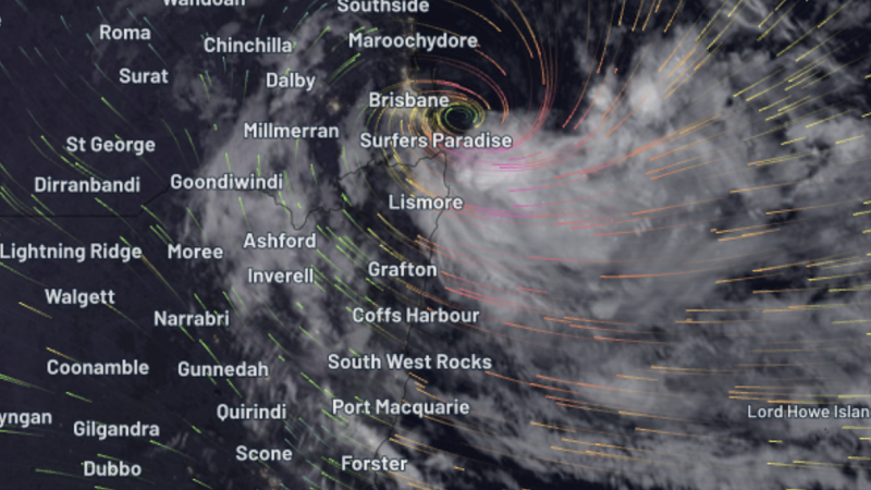
Brisbane City Council updated its flood map late Friday night following Bureau of Meteorology predictions for intense rainfall and an increased likelihood for flash flooding as Cyclone Alfred nears the south-east Queensland coast.
The new mapping, released at 8.40pm AEST, includes overland flow and an updated storm surge chart, which shows 20,350 properties at risk of storm surge and flooding.
“Residents are reminded every severe weather event is different and rainfall is difficult to predict,” the council wrote on social media.
“The flood map is for general awareness and is based on the best available information at the time.
“Even if your property isn’t marked as flooded, it could still be at risk.“
The updated flood map can be viewed here.

